Showing posts with label Siskiyou County. Show all posts

Saturday, June 26, 2021

Camping by Geographical Areas


This page is provided as an index to assist you in locating some of the great camping places you will find located in Siskiyou County. Please click on each site of interest to view accurate pictures of the campgrounds, list of amenities, and general information as well as driving directions. It is hoped you will find this information helpful and enhance your stay in Siskiyou County. Please return or bookmark this blog as new information is added!

** Indicates that the campground is open year-round if roads are accessible.

Please also click the links on the right sidebar for things to do and see along the different routes!

Please be sure you check to be sure there are no fires in the area you are planning to camp!  You will need a campfire permit for most campsites in Siskiyou County.  They are free, ask any ranger.   Also, note that the National Forest Service Campgrounds (NFS) are often seasonal only.  During Covid-19 double-check that the campgrounds are open.

Camping along the I-5 Corridor:  From Dunsmuir, CA to the Oregon Border on Interstate 5, Siskiyou County, California.
Camping along Highway 96 (The State of Jefferson Highway)
From Interstate 5 along the Klamath River to the county line at Somes Bar, CA


Camping along Highway 97 (The Road Less Traveled...)
From the intersection of I-5 and 97 at Weed, California to the Oregon State Line


Camping along Highway 89 East and South East towards Lassen National Park. From Interstate 5 (near Mt. Shasta City) towards Lassen National Park East on Highway 89:


Camping in outlying Siskiyou County areas!

Click here for:  Views along the Scott River
Dispersed Camping in the National Forests: Much of the forest is available for dispersed camping. This is camping in areas that are not official campsites. To obtain information go to any Forest Ranger Station or stop in at the Klamath National Forest Headquarters in Yreka, California. While at a station pick up a California Campfire Permit while there ~ they are often good for the entire season and free of charge. Please check the National Forest website for information on "dispersed camping".

Oak Bottom Campground


Brief description:  Forest Service Campground near the Salmon River.  Handicap access.

Open Dates:  May to October

Number of Campsites:  26 sites.  Max RV length 25 ft.  Watch overhead branches.  26 sites are accessible according to the website, however, there are specially marked accessible sites.

Length of Stay:  Not posted.

Fees:  Self-registration.  $10 per night.  At the last visit, a campground host was available in the campground.  There are Reservable sites by calling 877-844-6777 or visiting www.recreation.gov 

Affiliation:  US Forest Service

Location/Address:  Approximately 2 miles east of Somes Bar on primary forest route 93. Good two-lane road.  Lat. 41’ 22’39”  Long. 123’ 27’ 01” 


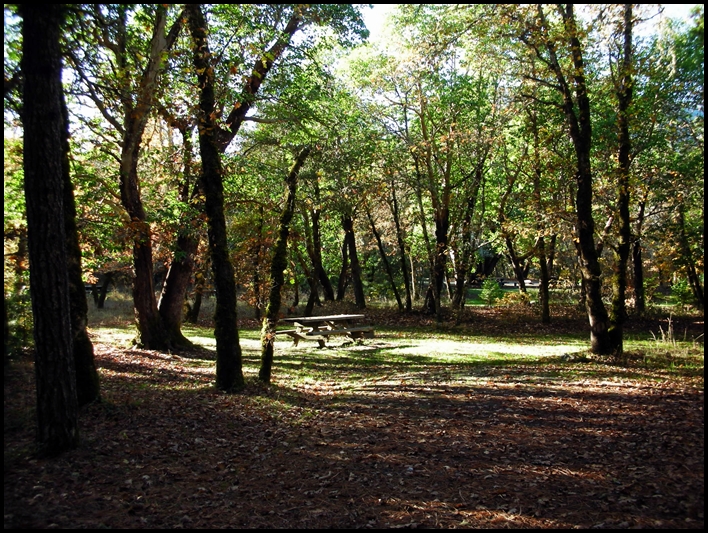
Typical campsite at Oak Bottom


Elevation:  700 ft.

Contact Information: 
Six Rivers National Forest
1330 Bayshore Way
Eureka, CA  95501
(707) 442-1721

Amenities:
Vault Toilets
River nearby
Firepits
Potable Water
Bear proof waste receptacles 
Trees with some open areas
Picnic tables
Fishing
Swimming/wading in the river in summer
Whitewater in spring

General Description:  Campground is in a mixed conifer and hardwood forest setting.  Leveling might be required.  Local wildlife includes deer, mountain lions, fox, squirrel, and raccoon.  Fishing at nearby Salmon River.  At the last visit, the campground had a camp host and the campground was exceptionally clean as were the vault toilets, etc.  There is poison oak in the area.

Nearby Services:  (groceries, medical, etc.) The nearest towns for groceries and propane are in Somes Bar 2.5 miles away.  (Very limited, however.)  Nearest hospital in Arcata CA 86 miles.  No cell service with AT&T, but a phone may be available via the camp host or at Somes Bar.


Friday, June 25, 2021

Trail Creek Campground


Typical Site at Trail Creek Campground.


Brief description:  Forest Service Campground near trails and river.  Sites are gravel, as is 1/4 mile of road leading to campground.

Open Dates:  May to October

Number of Campsites:  12 sites.  Max RV length 20 ft.  Some sites may accommodate a larger rig, watch overhead branches.

Length of Stay:  14 days

Fees:  Self-registration.  $10 per night when last stayed

Affiliation:  US Forest Service

Location/Address:  Approximately 13 miles NE of Cecilville on primary forest route 93.  The best route for pulling a trailer is to travel to Callahan, California, and take the Callahan-Cecilville Road (Route 93) 16.6 miles to the Trail Creek Campground.  The campground is located ¼ mile off Route 93, a somewhat steep decline to the campground entrance.

Elevation:  4,700 ft.

Contact Information: 

 Klamath National Forest 

Supervisor's Office (Headquarters)

1711 South Main St

Yreka, CA 96097

(530) 863-3092


Amenities:

Vault Toilets

River nearby

Firepits ~ Check local restrictions before having a campfire, outdoor barbeque, or stove.  A free  
       California campfire permit is available online and at Ranger Stations.  Local requirements  may
       supersede permits.

Potable Water

Bear proof waste receptacles 

Trees with some open areas

Picnic tables

General Description:  Campground is in a mixed conifer setting, however, there are some nice places to park a small trailer or RV.  Leveling might be required.  Local wildlife includes deer, bears and birds.  Access to the Pacific Crest Trail is nearby.  Hiking into the Trinity Alps wilderness nearby.  Fishing in nearby Salmon River.

Nearby Services:  (groceries, medical, etc.) The nearest towns for groceries and fuel are Etna, Ft. Jones, and Yreka, CA. (approximately 30 miles)  Nearest emergency health services in Yreka, California is approximately 60 miles.  


Sunday, August 2, 2020

Quigley's Store & RV Park


   Quigley's is Now Open!

Located right on the bank of the Klamath River one can find the historic Quigley's Store and RV Park!

As of 2020, there are new owners for Quigley's, and everything has been really improved!  Highly recommend you check it out, grab a beer sit on the deck, and enjoy the river!

While driving down the State of Jefferson Byway (California Hwy 96) one can find Quigley's Store and RV Park. This place is worth a stop even if you aren't ready to call it a day and find a place to camp. Walking inside the store is like a portal to the past, stepping on the oiled tongue and groove wooden floors, and a market that has a little bit of almost everything! The area was formerly visited by President Hoover as he was friends of the original owner, Willis Quigley. They also have a nice little Deli and great spot to eat out on the deck or cozy tables inside. One can find a light meal there for either Breakfast, Lunch, or Dinner ~ if they are open food will be available. The summer months this place is frequently full, but still worth the stop.

If you are looking for a very casual, out of the way place to visit this might be just the ticket! Area attractions include the Klamath National Forest, not to mention the scenic Klamath River with fishing and rafting right at your doorstep. Nearby is a 9 hole golf course, a shooting range, and hunting in the area during appropriate seasons for bear, deer, turkey, and quail. Along the Klamath River, one can watch gold mining operations and learn the area's vast gold mining history.

The RV facilities include cable TV with hookups. There are laundry facilities, a horseshoe pit, a sandy beach along the river, with canoeing, rafting, and kayaking. Thirteen of the 20 RV sites are located along the river with access. The park has 20 amp electrical service, a comfort station, and the roads and sites are gravel. A typical site is 25' X 40' and can accommodate up to a 40' rig. Pets are allowed but must be on a leash.

Great tidbits of history can be found at Quigley's Store & RV Park small webpage, it is definitely worth a read!

Directions to Quigleys:
From Yreka travel approximately 8 miles North on Hwy 263 (Historic Hwy 99) until you cross the Klamath River Bridge and then turn left on Hwy 96 (The Jefferson State Byway) then travel 15 miles west. From Interstate-5, turn off at Collier's Rest Stop (North of Yreka) and travel west on Hwy 96 17 miles to Quigley's. The park is on the south side (Riverside) of Hwy 96.
Reservations can be made by calling: (530) 465-2224.

Sunday, October 9, 2016

Gumboot Campground


Very brief description:   Primitive camping on the north side of a shallow alpine lake in an outlying area, but available by car.  Bring your own water. Poor signage in the area.  The campground itself no longer has an identifying sign as viewed in the photo below.  

Open Dates:  Depending on snow pack, Gumboot Campground is open from June to October.

Number of Campsites:  Six undeveloped sites with user made fire rings and some user made pathways.  Suitable for small trailers, campers and tents.  Max length of trailer 20 to 25 ft. but curves along the road can be tight and turnarounds will be minimal.  Parts of the road leading to the campground is in poor condition, although paved, and sections are very narrow.

Dispersed Camping:  There are a number of dispersed camping sites available for free camping as you travel the road west of the Lake Siskiyou once reaching the National Forest boundary as you head toward Gumboot Lake.  Many of these sites are right along the road; others are located on spur roads.  For detailed information on dispersed camping contact the Ranger Station or the website.
 
Length of Stay:  Length of stay is not posted, but likely 14 days.

Fees:  None.  Free.

Affiliation:  National Forest Service

Location/Address:  Gumboot Lake is approximately 16 miles from Mt. Shasta City on local roads.  From Mt. Shasta City at Interstate 5 take the Central Mt. Shasta exit and go West on West Ream Avenue.  Turn South on West Barr Road (Forest Route 26) towards Lake Siskiyou.  Follow West Barr Road and drive over Box Canyon Dam and drive past Lake Siskiyou.  Continue on the road and pass the entrance to Lake Siskiyou Campground.  From there continue along the same road and it will turn into Forest Route 40N26.  This road follows the canyon of the South Fork of the Sacramento River.  In places the road is very winding and narrow, drive carefully and watch for oncoming traffic and wildlife.  When you reach a fork in the road at about 15.5 miles look for a fork in the road, take the road to the left for ½ mile to Gumboot Lake.

Elevation:  Approximately 6,050 ft.
 Below is the parking and turn around area     
Contact Information
U. S. Forest Service
Mt. Shasta Ranger Station
204 West Alma
Mt. Shasta, CA  96067
(530) 926-4511

Amenities:
  • ·       Pit toilets
  • ·       User made fire rings
  • ·       Hiking
  • ·       Scenic


General Description:  Quiet and serene small alpine lake surrounded by a mixed conifer forest.  The lake sits in an open area with some grasses around.  A second, but smaller lake is nearby to the West.  A 2 mile drive from the lake is available to the Gumboot trail-head of the Pacific Crest Trail.  Views of Mt. Shasta and the Trinity Alps can be seen.  A 2 ½ mile (one way) hike south on the Pacific Crest Trail one can view and explore the Seven lakes Basin.  Some individuals have stated they can receive cell service in the open area by the lake, but it may be dependent on the carrier.  Most cell service is unavailable past Lake Siskiyou (about 10+ miles).

Nearby Services:  (groceries, medical, etc.)  Food, fuel, water, camping or hiking supplies are available in Mt. Shasta City. (16 miles)  Supplies are also available in nearby towns such as Weed, Yreka, or Dunsmuir. Nearest supplies would be in Mt. Shasta City.


Emergency:  Full service Emergency in Mt. Shasta at Mercy Medical Center (16 miles) and Yreka, at Fairchild Medical Center.

Friday, May 27, 2016

Lover's Camp


Brief description:  Beautiful treed area in the Marble Mountain wilderness area.  Tent camping only.  Many hiking and riding trails in this area.  The camp has 3 areas, corrals for horses and/or mules for packing into the mountains, parking area for livestock trailers, and a nice paved parking area for autos.  Walk into campsites.

Open Dates:  Open in May to October

Number of Campsites:   8 tent sites

Length of Stay:  14 days maximum

Fees:  Free!

Affiliation: Klamath National Forest Service

Location/Address:  Camp is located approximately 24 miles from Ft. Jones, California off of Hwy 3 and Scott River Road.  From Yreka travel Hwy 3 to Ft. Jones, take the Scott River Road for approximately 14 miles to the Indian Scotty and Lover’s Camp turn off.  (Sign post is well marked at turn).  Travel past Indian Scotty Camp and continue on the one lane paved road for 8 miles.  Some parts of the road are steep, and it is a winding road.  Watch for oncoming traffic, there are turnouts available.  In the spring runoff some places the water may cross the road.  The campground has essentially 3 areas, the first is horse corrals, the second area has the sign for the campground and the area is available for camping and parking livestock trailers.  Continue past the camping area sign for about ¼ mile and there will be a large paved parking lot adjacent to walk in campsites.

Elevation:  4,300 ft.

Contact Information:

Klamath National Forest
Supervisor’s  Office
1711 South Main Street
Yreka, CA  96097
(530) 842-6131


Amenities: 
·       Vault toilets
·       Fire rings
·       Some tables
·       Parking area
·       Water for horses only, not potable!
·       Gather firewood locally
·       Fishing in nearby lakes
     Livestock corrals


General Description:  Located in the trees with views of the Marble Mountain Wilderness.  Tent camping areas only, walk in.  Deer, bears, and birds frequent the area.  No trash service, no drinking water.  Bring in your own water, as well as water for dowsing campfires.  Remove all trash you bring in as well as clean up after dogs, and pack out.  Dogs on leash only.  Summers are moderate.  Contact the Forest Service for Packing Outfitters who are authorized to operate in the area.  Many trails give access to the Marble Mountain Wilderness via Canyon Creek and Red Rock Trails.  This is a lightly used campground.


Nearby Services:  (groceries, medical, etc.)  Nearest fuel and food located in Ft. Jones, approximately 24 miles.  Nearest Emergency room access would be Fairchild Medical Center in Yreka, approximately 42 miles.  Major supplies available in Yreka, California (42 miles).

Friday, July 3, 2015

Blue Heron RV Park


Brief description:  A RV park that caters to large Motor Homes and RV’s.  The park is situated right along the Klamath River and provides full amenities for large rigs.

Open Dates:  Open year round

Number of Campsites:  25+

Length of Stay:  Daily, weekly, monthly

Fees:  $49 per night.  $210 week, monthly rate is $500 plus electricity.  Reservations accepted on line and via phone.

Affiliation:  Private Commercial Park  

Location/Address:   7630 Copco Rd, Hornbrook, CA 96044

Elevation:  Approximately 2300 ft. above sea level

Contact Information:  (530) 475-3270    www.klamathranchresort.com
  
Amenities
·         Full hookups
·         70 x 35 concrete pads with patio
·         Paved streets
·         Free wifi
·         River front sites
·         Modern restroom, bathhouse and laundry
·         Overnight RV rentals
·         Fishing
·         Hiking, bicycling, and bird watching
·         Adjacent restaurant and small convenience store

General Description:  Located along the Klamath River along a sunny slope.  Small trees provide decorative additions.  Paved streets and large concrete pads.  Accommodates large Motor Homes, RV’s and 5th wheels with ease.  A restaurant is located adjacent to the park as well as a small convenience store.   

Nearby Services:   Restaurant and convenience store adjacent to park.  Fuel 6 miles in Hornbrook.  Full service shopping, fuel, RV repair, and medical care (Emergency Room in Hospital as well as walk in clinics during weekdays)  in Yreka, 15 miles south on Interstate 5 (Plus the 6 miles on the county road to the park).
  
How to get thereTake exit 789 off Interstate 5 in northern California. The exit is 9 miles south of the California/Oregon border and 13 miles north of exit 776 at Yreka, California. When you reach exit 789, follow the signs. Keep the river on your right for about 6 miles.  Watch for animals on the roads (deer, etc.).


Monday, May 25, 2015

Iron Gate Reservoir Camping


Brief description:  Iron Gate Reservoir is located about 10 miles east of Interstate 5 and continues upstream to Copco Reservoir.  The road to Iron Gate Reservoir is about 15 miles north of Yreka, CA off of Interstate 5.  Popular for boating, water skiing, and fishing.

Open Dates:  Campgrounds at Iron Gate Reservoir are being closed to the public as of May 12, 2023.  The Dam that created the lake is going to be demolished.  

Number of Campsites:  Camp Creek:  22 sites; Juniper Point Camp:   9 sites; Mirror Cove Camp:  10 sites.  Sometimes camping may be available in other day use areas.

Length of Stay:  14 days maximum

Fees:  FREE!  No charge for camping, boat launching, etc.  No reservations first come first served.

Affiliation:  Pacific Power (PacifiCorp) campgrounds and Bureau of Land Management.


Location/Address:  From the Hornbrook/Henley Interstate 5 exit (#789) go in an easterly direction.  There are small road signs near the exit.  Travel approximately 10 to 11 miles on county roads until you reach the sign that shows the general reservoir and camping areas.  It is located along the Klamath River.  Once at the entrance near the fish hatchery, depending on the campground selected you may travel another 4 or 5 miles, perhaps more.  Many of the sites are located along the lake’s west side and the lake is 7 miles long.  The roads are paved up to the turn offs into the camping areas (gravel) but are often in need of some repair.  Suggest one drives slowly due to open range and deer, cattle or horses could be on the road. 

Wildlife:  Squirrels, pelicans, sea gulls, numerous types of birds of prey, possible deer or raccoon's.  In the warm days and months be  aware there are snakes in the area.  Both rattlesnakes and others.
Camp Creek Boat Launch

Elevation:  Approximately 2,350 feet above sea level. 

Contact Information:  For boating information contact:

U. S. Bureau of Land Management
Klamath Falls Office
(541-883-6916

Amenities:
·              Camp sites with fire rings, pit toilets, tables
·               Boat ramps and docks at Mirror Cove, and Camp Creek
·               RV Dump station at Camp Creek
·              Water only available at Camp Creek Campground
·              RV’s and Tents welcomed.  Some sites will accommodate up to 30 ft. trailers or RV’s
·              Fishing
·              Swimming
·             Boating
 
Mirror Cove Campground
General Description:  Rolling type hills with small oaks and brush.  Reservoir.  Can be windy but often the water is good for water skiing; generally the wind comes up in the afternoon for 2 or 3 hours and then subsides during the summer months.  Can be very warm during the days in the summer, but evenings usually cool down somewhat.  Spring is the nicest time in the area, with nice days and cool nights.  In the spring the hills are generally still green and lush, in the summer the area becomes very dry on the surrounding hills.  During warm months be aware of rattlesnakes in the area, especially when hiking.  Minimal cell phone reception in the area.  Only one camp area has potable water.
 
Camp Creek Campground

Nearby Services:  (groceries, medical, etc.)  Nearest fuel is at the exit at Hornbrook along Interstate 5.  Nearest hospital and medical services in Yreka, California approximately 15 miles from Hornbrook and 25+ miles from camp grounds.  Some food or restaurants available in Hornbrook, but nearest full service area would be Yreka.  Yreka would have supplies, equipment, auto repair, fuel, groceries and medical care.  A small restaurant is located near a commercial campground (The Fish Hook Restaurant) about 5 miles from the entrance to the reservoir area.

Friday, April 18, 2014

Red Bank Public Camp


Red Bank Public Campground
Near Forks of the Salmon and situated in a dense area of pine, Madrone and fir trees.  Campground sits adjacent to the North Fork of the Salmon River.

This campground is currently closed (June 2021)

Open Dates:  May - October

Number of Campsites:  5 campsites

Length of Stay:  14 days

Fees:  Free!

Affiliation:  National Forest Service

Location/Address:  Approximately 7 miles north east of Forks of Salmon on county route 1C01.  From Yreka, California drive on Hwy 3 to Fort Jones, California.  Continue on Hwy 3 to Etna, California. (*Part of this route is on a very narrow winding road with steep cliffs.) From Etna take Sawyers Bar Road and drive approximately 32 miles.  Campground will be on the left if traveling in west direction.  This campground can also be accessed from Happy Camp, California on Hwy 96.  From Happy Camp drive approximately 38 miles to Salmon River Road, continue for 17 miles to Sawyers Bar Road and drive 7 miles to campground.

Elevation: 2200 feet

Contact Information:
Klamath National Forest (Supervisor’s Office)
1711 South Main Street
Yreka, CA  96097
(530) 842-6131

Amenities:
  • River fishing, trout can be caught from the banks
  • Vault toilets at last visit were available

General Description:  Dispersed type camping.  No drinking water, no hookups, no showers.  Pack out garbage.  Beautiful scenery.  Deer, bears, and birds can be seen in this area.  No designated trails in area.  Out of the way camping.  Be sure to obtain a campfire permit before using a barbecue, campfire, or outside cooking device.

Nearby Services:  (groceries, medical, etc.)  Some groceries and fuel may be obtained at Forks of Salmon approximately 7 miles away.  Nearest full service fuel and groceries in Etna, Fort Jones, Yreka or Orleans, California.  Nearest full service medical and emergency services:  Scott Valley Rural Health Services, Etna, CA 26 miles; Curry General Hospital, Orick, CA 38 miles; Fairchild Hospital, Yreka, CA approximately 75 miles.


Sunday, April 13, 2014

Nordheimer Flat Campground and River Access


Entrance to Nordheimer Campground, sign is visible adjacent to Salmon River Road.


Brief description:  Campground is located in mixed forest with Conifers, Oak and Madrone.  Some sites have creek views.  Salmon fishing in Nordheimer Creek and Salmon River.

Open Dates:  May to October for campground usage.  River access available year round.

Number of Campsites:  Approximately 12 single sites, and 4 group sites.  Individual sites first come, first served.  Reservations only possible for group sites.  By reservation only at www.recreation.gov or 1-877-444-6777.

Length of Stay:   14 days

Fees:  Approximately $10 per day, check current rates as they may change for new season.

Affiliation:  National Forest Campground.  Campground is administered by the Six Rivers National Forest.


Location/Address:  Nordheimer Flat Campground is approximately 12-14 miles East of Somes Bar on Forest Route 93 (Salmon River Road).  ~ Traveling from Orleans on Hwy 96 travel north about 8 miles to Somes Bar turn on Salmon River Road going east.  ~ Traveling from Happy Camp on Hwy 96 along the Klamath River Drive south approximately 38 miles to Somes Bar and turn on Salmon River Road going east.

Elevation:  approximately 1,000 ft.

Contact Information:
Klamath National Forest
Supervisor’s Office
1711 South Main Street
Yreka, CA  96097
(530) 842-6131

Amenities: 
  • Campfire rings ~ A current California Campfire Permit is required to use a camp stove, barbecue or have a campfire.  Local fire restrictions supersede the campfire permit. Inquire at the Ranger Station before having a fire.
  • Vault toilets
  • Drinking water in summer months is generally available
  • Fishing
  • Boat access (non-motorized) to river’s edge (Salmon River) is possible with 4 x 4 vehicles, level is intermediate to difficult.  Quagga and Zebra Mussel Alert.
  • Remnants from historic mining operations can still be seen in this remote but beautiful camping area. A few fruit trees remain from past homesteading activities.
  • Gold panning is regulated on the Salmon River by the California Department of Fish and Game.

General Description:  Somewhat remote camping area, but access is easily available by automobile.  The campground has large flat areas, some areas sunny others in wooded areas with Conifers, Oak and Madrone.  Deer, foxes, raccoons, and squirrels in the area.   Riparian wildlife. Can be busy during holidays, but generally light usage.


Nearby Services:  (groceries, medical, etc.)  Limited supplies available at Somes Bar 12+ miles.  Also at Orleans approximately 20 miles.  Full service groceries available at Willow Creek 40+ miles or at Happy Camp approximately 50 miles.  Urgent care available at Curry General Hospital at Orick, California.    Emergency services (25 miles south west from Somes Bar) from Hoopa-Willow Creek Ambulance, 1200 Airport Rd., Hoopa, CA.  (530) 625-4180 Gasoline available at Willow Creek and possibly other areas depending on day and time. 

Wednesday, September 4, 2013

Dillon Campground


Dillon Campground

Elevation:  800 ft.

Number of campsites:  21

Affiliation:  National Forest Campground – Klamath National Forest – Ukonom Ranger District.

Open Dates:  May through October:  Maximum Stay, 14 days.

Location/address:  Located off of Highway 96 between the towns of Happy Camp and Somes Bar.  Sign well marked from road.

Contacts:  Klamath National Forest Headquarters
                    1711 South Main Street
                    Yreka, CA  96097
                    (530) 842-6131
         
                     Six RiversNational Forest
                     1330 Bayshore Way
                     Eureka, CA 95501
                    (707) 442-1721

                   Ukonom Ranger District
                   P. O. Box 410
                   Orleans, CA  95556
                   (530) 627-3291

Reservation information:  Campsites on a first come basis.


 Price for camping:  $10 - $20  Extra charges for more than one vehicle.  Day use available for reduced fee.

Amenities:
     

Wheel chair access
 
Vault toilets
·         Picnic
·         River Access
·         Water
·         Rafting
·         Hunting
·         Fishing
·         Mountain Bikes
·         Swimming -- River
·         Hiking


 General description:  Campground is located in forested area adjacent to Hiway 96.  Shaded area in trees and mountains alongside a stream.  The superb natural swimming hole is a popular place on hot summer days.  Trails near the campground.  Bear proof garbage containers at campground.  Poison oak in the area.  Campsites offer picnic tables and grills.


 Supplies, Medical Assistance, EtcGroceries and fuel possibly at Somes Bar or in the small town of Orleans.  Minimal supplies available 1 ½ to 6 miles, Hoopa 20 miles.  Full services in Yreka, 110 miles.  Full service ER in Yreka, 110 miles.  Full service medical in Arcata 40 miles west.


Sunday, November 4, 2012

Curly Jack Campground


Curly Jack Campground Entrance Sign


Curly Jack Campground is located just on the "outskirts" of the small town of Happy Camp, along the State of Jefferson Scenic Byway.  It is a tricky to find if you don't have exact directions.  This campground is situated right alongside the Klamath River and is located largely in a setting with small oak trees, madrone and pines.  A stop at the Happy Camp Ranger District office just a short distance up the road will help one find this camp ground easily.

Number of Campsites:  16, including 3 group campsites.  Reservations are required for group campsites, the others are first come first served.  Can accommodate tents and RV's up to 42 ft with 2 sites being able to accommodate 60 ft.  There may be low overhang in parts of the campground.  There is a RV sanitary station in town, but not at the campsite.
Typical Campsite


Fees:  Self Registration at entrance, $15 per night, 5 persons max per campsite.  14 day limit. America the Beautiful pass and Senior Access passes accepted for family sites.


Affiliation:  U. S. Forest Service.


Turn off of Hwy 96 to Elk Creek Rd, and then onto Curly Jack Road look for bridge
Location/Address:  Located at the west end of Happy Camp (some directions say 1 mile) via county route 7C001.  From Interstate 5 travel 65 miles to Happy Camp along Highway 96, Klamath River Hwy.  Turn a slight left onto Elk Creek Road from Hwy 96 (just past Happy Camp) and continue onto Curly Jack Road.  Look for the bridge that will cross the river.

Elevation:  1130 feet.

Contact Information:

Klamath National Forest Headquarters
1711 South Main Street
Yreka, CA  96097
(530) 842-6131

Happy Camp Ranger District
P. O. Box 377
Happy Camp, CA  96039
(530) 493-1777
Look for the tiny tent sign for directions

Amenities:

  • Vault Toilets
  • Drinking Water
  • Some campsites can accommodate wheelchairs with assistance
  • Fire Rings
  • Garbage pick up in Summer (only in summer)
  • Paved parking spurs
  • Several campsites with view of river
  • Easy access to river from campground
  • Fishing
  • Swimming  and wading ~ at own risk
  • Good area for birding and other wildlife viewing
General Description:   This campground is within walking distance to Happy Camp, but is across the river in a somewhat secluded area.  This is bear country even though it is close to town, please secure your food when not in use.  The campground is in a shady and scenic area.  During early and late season please pack out trash when garbage service is not available.  Please keep dogs on leash only.  Cell service is generally not received, GPS coordinates may not register.

Emergency:  Call 911.  Full service ER in Yreka, California (65 miles) or Emergency Medical Evacuation available in Happy Camp via the Mercy Flights Medical Evacuation Services, 2020 Milligan Way, Medford, Oregon  97504 (1-800-903-9000).  Additional information at:  http://happycampca.com/medical.html