Showing posts with label Handicap access. Show all posts

Saturday, June 26, 2021

Oak Bottom Campground


Brief description:  Forest Service Campground near the Salmon River.  Handicap access.

Open Dates:  May to October

Number of Campsites:  26 sites.  Max RV length 25 ft.  Watch overhead branches.  26 sites are accessible according to the website, however, there are specially marked accessible sites.

Length of Stay:  Not posted.

Fees:  Self-registration.  $10 per night.  At the last visit, a campground host was available in the campground.  There are Reservable sites by calling 877-844-6777 or visiting www.recreation.gov 

Affiliation:  US Forest Service

Location/Address:  Approximately 2 miles east of Somes Bar on primary forest route 93. Good two-lane road.  Lat. 41’ 22’39”  Long. 123’ 27’ 01” 


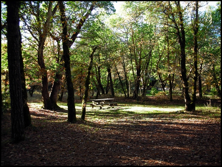
Typical campsite at Oak Bottom


Elevation:  700 ft.

Contact Information: 
Six Rivers National Forest
1330 Bayshore Way
Eureka, CA  95501
(707) 442-1721

Amenities:
Vault Toilets
River nearby
Firepits
Potable Water
Bear proof waste receptacles 
Trees with some open areas
Picnic tables
Fishing
Swimming/wading in the river in summer
Whitewater in spring

General Description:  Campground is in a mixed conifer and hardwood forest setting.  Leveling might be required.  Local wildlife includes deer, mountain lions, fox, squirrel, and raccoon.  Fishing at nearby Salmon River.  At the last visit, the campground had a camp host and the campground was exceptionally clean as were the vault toilets, etc.  There is poison oak in the area.

Nearby Services:  (groceries, medical, etc.) The nearest towns for groceries and propane are in Somes Bar 2.5 miles away.  (Very limited, however.)  Nearest hospital in Arcata CA 86 miles.  No cell service with AT&T, but a phone may be available via the camp host or at Somes Bar.


Wednesday, May 11, 2016

Pilgrim Creek Snowmobile Park and Campground


Brief description:   Somewhat remote snowmobile park that has a staging area for winter and is available for camping during the rest of the year.

Open Dates:  Estimated year round if road is open.

Number of Campsites:  No “official” campsites, large paved parking lot area available to park trailers and RV’s.

Length of Stay:  14 days unless otherwise approved.

Fees:  Free.
 
Road to Pilgrim Creek Area
Affiliation:  Shasta-Trinity National Forest.

Location/Address:  8 miles from McCloud, California.  From McCloud travel east on Hwy 89 for approximately 3 miles and turn left on Pilgrim Creek Road (Road #13).  Travel 5 miles on the paved road and the park will be on your left. 

Elevation:  Approximately 3,500 – 4,000 ft.

Contact Information:  Shasta-Trinity National Forest, McCloud Ranger Station, P.O. Box 1620, McCloud, Ca 96057
(530) 964-2184
 
Typical Parking Space for RV or Trailer
Amenities: 
  • Paved parking lot for trailer and RV camping
  • Vault Toilets
  • Warming hut
  • Ramp for unloading  snowmobiles
  • Trees
  • Groomed snowmobile trails ~ contact ranger station for details.

General Description:  Large paved parking area in somewhat remote area, but fully accessible by paved roads.  Could be a nice free spot to camp in RV or trailer overnight while traveling the area. 
 
The Warming Hut
 Nearby Services:  (groceries, medical, etc.)  Nearest services in McCloud approximately 8 miles away.  Nearest hospital or medical services in Mt. Shasta City approximately 23 miles.  

Sunday, June 9, 2013

Hat Creek Campground


Hat Creek Campground


Brief description:  Nice campground at approximately the 4,400 ft level.  The campground follows the inviting Hat Creek, a haven for trout fly fisherpersons.

Open Dates:  April – October weather permitting.

Number of Campsites:  Over 70 single sites and 3 group sites.  Maximum spur about 20 feet.

Length of Stay:  14 days


Fees:  $16 per site.  Golden Age passport gives a 50% discount.

Affiliation:  National Forest Campground

Location/Address:  Located 26 miles from Burney, California one mile from Old Station along Hwy 89 near the intersection of State Route 44 and 89.

Elevation:  4,400 ft.

Contact Information:
Lassen National Forest
2550 Riverside Drive
Susanville, CA  96130
(530) 257-2151


Amenities:
  • World class trout fly fishing
  • Hiking
  • Near Lassen Volcanic National Park
  • Picnic tables
  • Drinking water
  • Flush and vault toilets
  • *Due to swift current in Hat Creek swimming is discouraged
  • One mile from Subway Cave, a volcanic lava flow tunnel
 General Description:  Large campground in and among Ponderosa and Jeffery pines along the bank of Hat Creek.  The area is renowned for fly fishing in the swift, cold waters of Hat Creek.  Busy during the summer.  Accessible fishing access.  Near Lassen National Park.  


Nearby Services:  (groceries, medical, etc.)  Old Station Visitor’s Center is nearby.  Full service market at Burney, CA approximately 19 miles.  Nearest medical services at:
Mayers Memorial Hospital
43563 Highway 299 East

Fall River Mills, CA  96028

Sunday, November 4, 2012

Curly Jack Campground


Curly Jack Campground Entrance Sign


Curly Jack Campground is located just on the "outskirts" of the small town of Happy Camp, along the State of Jefferson Scenic Byway.  It is a tricky to find if you don't have exact directions.  This campground is situated right alongside the Klamath River and is located largely in a setting with small oak trees, madrone and pines.  A stop at the Happy Camp Ranger District office just a short distance up the road will help one find this camp ground easily.

Number of Campsites:  16, including 3 group campsites.  Reservations are required for group campsites, the others are first come first served.  Can accommodate tents and RV's up to 42 ft with 2 sites being able to accommodate 60 ft.  There may be low overhang in parts of the campground.  There is a RV sanitary station in town, but not at the campsite.
Typical Campsite


Fees:  Self Registration at entrance, $15 per night, 5 persons max per campsite.  14 day limit. America the Beautiful pass and Senior Access passes accepted for family sites.


Affiliation:  U. S. Forest Service.


Turn off of Hwy 96 to Elk Creek Rd, and then onto Curly Jack Road look for bridge
Location/Address:  Located at the west end of Happy Camp (some directions say 1 mile) via county route 7C001.  From Interstate 5 travel 65 miles to Happy Camp along Highway 96, Klamath River Hwy.  Turn a slight left onto Elk Creek Road from Hwy 96 (just past Happy Camp) and continue onto Curly Jack Road.  Look for the bridge that will cross the river.

Elevation:  1130 feet.

Contact Information:

Klamath National Forest Headquarters
1711 South Main Street
Yreka, CA  96097
(530) 842-6131

Happy Camp Ranger District
P. O. Box 377
Happy Camp, CA  96039
(530) 493-1777
Look for the tiny tent sign for directions

Amenities:

  • Vault Toilets
  • Drinking Water
  • Some campsites can accommodate wheelchairs with assistance
  • Fire Rings
  • Garbage pick up in Summer (only in summer)
  • Paved parking spurs
  • Several campsites with view of river
  • Easy access to river from campground
  • Fishing
  • Swimming  and wading ~ at own risk
  • Good area for birding and other wildlife viewing
General Description:   This campground is within walking distance to Happy Camp, but is across the river in a somewhat secluded area.  This is bear country even though it is close to town, please secure your food when not in use.  The campground is in a shady and scenic area.  During early and late season please pack out trash when garbage service is not available.  Please keep dogs on leash only.  Cell service is generally not received, GPS coordinates may not register.

Emergency:  Call 911.  Full service ER in Yreka, California (65 miles) or Emergency Medical Evacuation available in Happy Camp via the Mercy Flights Medical Evacuation Services, 2020 Milligan Way, Medford, Oregon  97504 (1-800-903-9000).  Additional information at:  http://happycampca.com/medical.html


Tuesday, January 13, 2009

Lake Siskiyou Camp


Left: Fishing Pier at marina, Right: typical camping spot with full hook ups for RV's.

Lake Siskiyou Resort Camp
(530) 926-2618
4239 West A. Barr Road
Mt. Shasta City, CA

This is a commercial establishment open from April 1 through October 31, snow levels permitting opening. Close to Interstate 5 at Mt. Shasta City. Great for weekend or longer camping, and a pleasant place to stay while traveling I-5 en route. The campground offers a wide variety of camp spaces from full hook up, to water and electric only, to simple tent spots. Cabins and other accommodations are also available.

Great fishing, boating, swimming, relaxing, and a nice hiking trail around the lake. Nice boat ramp. Convenience store on site as well as small eatery with pizza and similar foods. Total number of camping spots unknown but there are over 200, information can be obtained during the season via phone, and some information can be found at their website listed below.

Lake Siskiyou is a local favorite for day use as well as for longer camping, some campsites are near the lake and others are a bit more secluded. The images above show a photo of the lake at the marina with the fishing dock in view along with Mt. Shasta in the background and the image on the right shows a sample of one of the campsites along the main road in the park ~ please note this image was taken when the campground was closed during winter. Summers generally have pleasant days and a bit cooler evenings.

Check out our video on Lake Siskiyou here!

They have a nice swimming area separate from the boating areas as pictured here:


How to get there: From Interstate 5 take the Central Mt. Shasta exit at W. Ream Avenue. Travel West. Go to the stop sign at Forest Route #26 (aka as West A. Barr Rd.) and travel South. (turn left) Continue on West A. Barr Rd. (Forest Route #26), stay to the right when you come to a Y in the road. Travel past the Mt. Shasta Resort Golf Course (will be to the South) and continue down this road. Shortly past the Golf Course Lake Siskiyou will be visible as you cross a small bridge. Continue on this road for a couple of miles as you travel around the West side of the Lake. Look for signage at the entrance on your right.

Cost and other information is currently unknown, please call for information at number listed at the top of this post.  Website:  Lake Siskiyou Resort.

Tuesday, April 29, 2008

Tree of Heaven Campground (NFS)


Camping in Siskiyou County, California


Click here for more photos of Tree of Heaven Campsite.

Open: May through October
Along California State Hwy 96 (in the State of Jefferson)

Name of Campground: Tree of HeavenElevation: Approx. 2100 ft.
Number of campsites: 20 family sites. 1 Handicapped accessible site.
Affiliation: National Forest Campground – Klamath National Forest – Scott River Ranger District.
Open Dates: Open Year Round: Maximum Stay, 14 days.

Location/address: Located on Hwy 96 approximately 4 miles East from Historic Hwy 99 (aka Hwy 263 and State Hwy 3) intersection a few miles north of Yreka, California.
Directions from Yreka: Accessible off of Interstate 5 at Yreka, Ca. From Yreka take Main Street going north. Main Street is Historic Hwy 99, currently known as Hwy 263 or Hwy 3. Travel about 7 miles to intersect Hwy 96 (State of Jefferson Highway). Take a hard left and travel 4 miles East. Campground will be on left down a hill.
Notes: This is a nice campground for RV's, tents, trailers, bikers and all others. Large motor homes (Class C) may find it unsuitable. Maximum spur is 34 feet. A easy choice for I-5 travelers wanting a "get away" spot for the evening while transiting the area. Great for fishing, relaxing, lots of shade. Right on the river.
Tree of Heaven Birding Nature Trail: There is a 1/4 mile trail that begins at the campground area and winds along the riparian habitat of the Klamath River. There are interpretive signs that cover bird identification, adaptations, habitat selection and fire ecology.
Services nearby: Groceries, fuel, fishing supplies, hospital in nearby Yreka.
Campground Information

Contacts: Klamath National Forest Headquarters
1711 South Main Street
Yreka, CA 96097
(530) 842-6131

Scott River Ranger District
11263 N. Hiway 3
Ft. Jones, CA 96032
(530) 468-1298

Reservation information: Reservations required for group site. Contact regarding reservations for individual campsites.


Price for camping: $15 family site.
Amenities:

Wheel chair access
Vault toilets
· Picnic/Hiking
· River Access
· Drinking Water
· Boating -- launch
· Rafting
· Fishing
· Birding/nature trail
· Horseshoes & volleyball
General description: Campground is located on the banks of the Klamath River. Shaded and open areas available. Year round trout fishing, seasonal salmon and steelhead fishing. Boat launch. Volleyball and horseshoe pits. Good river access. Birding/nature trail in the campground. Prepare for mosquitoes in the summer.

Trailer/RV suitability: Many areas easily accessible for trailers. Road into campground is somewhat steep, however.