Showing posts with label Fishing. Show all posts

Saturday, June 26, 2021

Camping by Geographical Areas


This page is provided as an index to assist you in locating some of the great camping places you will find located in Siskiyou County. Please click on each site of interest to view accurate pictures of the campgrounds, list of amenities, and general information as well as driving directions. It is hoped you will find this information helpful and enhance your stay in Siskiyou County. Please return or bookmark this blog as new information is added!

** Indicates that the campground is open year-round if roads are accessible.

Please also click the links on the right sidebar for things to do and see along the different routes!

Please be sure you check to be sure there are no fires in the area you are planning to camp!  You will need a campfire permit for most campsites in Siskiyou County.  They are free, ask any ranger.   Also, note that the National Forest Service Campgrounds (NFS) are often seasonal only.  During Covid-19 double-check that the campgrounds are open.

Camping along the I-5 Corridor:  From Dunsmuir, CA to the Oregon Border on Interstate 5, Siskiyou County, California.
Camping along Highway 96 (The State of Jefferson Highway)
From Interstate 5 along the Klamath River to the county line at Somes Bar, CA


Camping along Highway 97 (The Road Less Traveled...)
From the intersection of I-5 and 97 at Weed, California to the Oregon State Line


Camping along Highway 89 East and South East towards Lassen National Park. From Interstate 5 (near Mt. Shasta City) towards Lassen National Park East on Highway 89:


Camping in outlying Siskiyou County areas!

Click here for:  Views along the Scott River
Dispersed Camping in the National Forests: Much of the forest is available for dispersed camping. This is camping in areas that are not official campsites. To obtain information go to any Forest Ranger Station or stop in at the Klamath National Forest Headquarters in Yreka, California. While at a station pick up a California Campfire Permit while there ~ they are often good for the entire season and free of charge. Please check the National Forest website for information on "dispersed camping".

Oak Bottom Campground


Brief description:  Forest Service Campground near the Salmon River.  Handicap access.

Open Dates:  May to October

Number of Campsites:  26 sites.  Max RV length 25 ft.  Watch overhead branches.  26 sites are accessible according to the website, however, there are specially marked accessible sites.

Length of Stay:  Not posted.

Fees:  Self-registration.  $10 per night.  At the last visit, a campground host was available in the campground.  There are Reservable sites by calling 877-844-6777 or visiting www.recreation.gov 

Affiliation:  US Forest Service

Location/Address:  Approximately 2 miles east of Somes Bar on primary forest route 93. Good two-lane road.  Lat. 41’ 22’39”  Long. 123’ 27’ 01” 


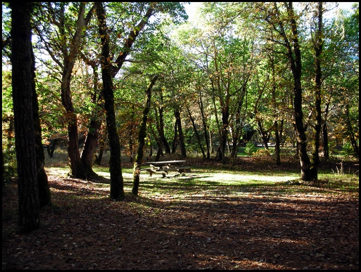
Typical campsite at Oak Bottom


Elevation:  700 ft.

Contact Information: 
Six Rivers National Forest
1330 Bayshore Way
Eureka, CA  95501
(707) 442-1721

Amenities:
• Vault Toilets
• River nearby
• Firepits
• Potable Water
• Bear proof waste receptacles 
• Trees with some open areas
• Picnic tables
• Fishing
• Swimming/wading in the river in summer
• Whitewater in spring

General Description:  Campground is in a mixed conifer and hardwood forest setting.  Leveling might be required.  Local wildlife includes deer, mountain lions, fox, squirrel, and raccoon.  Fishing at nearby Salmon River.  At the last visit, the campground had a camp host and the campground was exceptionally clean as were the vault toilets, etc.  There is poison oak in the area.

Nearby Services:  (groceries, medical, etc.) The nearest towns for groceries and propane are in Somes Bar 2.5 miles away.  (Very limited, however.)  Nearest hospital in Arcata CA 86 miles.  No cell service with AT&T, but a phone may be available via the camp host or at Somes Bar.


Friday, June 25, 2021

Trail Creek Campground


Typical Site at Trail Creek Campground.


Brief description:  Forest Service Campground near trails and river.  Sites are gravel, as is 1/4 mile of road leading to campground.

Open Dates:  May to October

Number of Campsites:  12 sites.  Max RV length 20 ft.  Some sites may accommodate a larger rig, watch overhead branches.

Length of Stay:  14 days

Fees:  Self-registration.  $10 per night when last stayed

Affiliation:  US Forest Service

Location/Address:  Approximately 13 miles NE of Cecilville on primary forest route 93.  The best route for pulling a trailer is to travel to Callahan, California, and take the Callahan-Cecilville Road (Route 93) 16.6 miles to the Trail Creek Campground.  The campground is located ¼ mile off Route 93, a somewhat steep decline to the campground entrance.

Elevation:  4,700 ft.

Contact Information: 

 Klamath National Forest 

Supervisor's Office (Headquarters)

1711 South Main St

Yreka, CA 96097

(530) 863-3092


Amenities:

• Vault Toilets

• River nearby

• Firepits ~ Check local restrictions before having a campfire, outdoor barbeque, or stove.  A free  
       California campfire permit is available online and at Ranger Stations.  Local requirements  may
       supersede permits.

• Potable Water

• Bear proof waste receptacles 

• Trees with some open areas

• Picnic tables

General Description:  Campground is in a mixed conifer setting, however, there are some nice places to park a small trailer or RV.  Leveling might be required.  Local wildlife includes deer, bears and birds.  Access to the Pacific Crest Trail is nearby.  Hiking into the Trinity Alps wilderness nearby.  Fishing in nearby Salmon River.

Nearby Services:  (groceries, medical, etc.) The nearest towns for groceries and fuel are Etna, Ft. Jones, and Yreka, CA. (approximately 30 miles)  Nearest emergency health services in Yreka, California is approximately 60 miles.  


Sunday, August 2, 2020

Quigley's Store & RV Park


   Quigley's is Now Open!

Located right on the bank of the Klamath River one can find the historic Quigley's Store and RV Park!

As of 2020, there are new owners for Quigley's, and everything has been really improved!  Highly recommend you check it out, grab a beer sit on the deck, and enjoy the river!

While driving down the State of Jefferson Byway (California Hwy 96) one can find Quigley's Store and RV Park. This place is worth a stop even if you aren't ready to call it a day and find a place to camp. Walking inside the store is like a portal to the past, stepping on the oiled tongue and groove wooden floors, and a market that has a little bit of almost everything! The area was formerly visited by President Hoover as he was friends of the original owner, Willis Quigley. They also have a nice little Deli and great spot to eat out on the deck or cozy tables inside. One can find a light meal there for either Breakfast, Lunch, or Dinner ~ if they are open food will be available. The summer months this place is frequently full, but still worth the stop.

If you are looking for a very casual, out of the way place to visit this might be just the ticket! Area attractions include the Klamath National Forest, not to mention the scenic Klamath River with fishing and rafting right at your doorstep. Nearby is a 9 hole golf course, a shooting range, and hunting in the area during appropriate seasons for bear, deer, turkey, and quail. Along the Klamath River, one can watch gold mining operations and learn the area's vast gold mining history.

The RV facilities include cable TV with hookups. There are laundry facilities, a horseshoe pit, a sandy beach along the river, with canoeing, rafting, and kayaking. Thirteen of the 20 RV sites are located along the river with access. The park has 20 amp electrical service, a comfort station, and the roads and sites are gravel. A typical site is 25' X 40' and can accommodate up to a 40' rig. Pets are allowed but must be on a leash.

Great tidbits of history can be found at Quigley's Store & RV Park small webpage, it is definitely worth a read!

Directions to Quigleys:
From Yreka travel approximately 8 miles North on Hwy 263 (Historic Hwy 99) until you cross the Klamath River Bridge and then turn left on Hwy 96 (The Jefferson State Byway) then travel 15 miles west. From Interstate-5, turn off at Collier's Rest Stop (North of Yreka) and travel west on Hwy 96 17 miles to Quigley's. The park is on the south side (Riverside) of Hwy 96.
Reservations can be made by calling: (530) 465-2224.

Monday, April 28, 2014

Idlewild Campground


Very brief description:  Campground is located along the North Fork of the Salmon River in medium to dense forest setting.  Nearby to Marble Mountain wilderness and Russian wilderness.


Open Dates:  May to October

Number of Campsites:  11 family campsites in tent camping area.  15 campsites in RV area.  Max spur 24’.  Watch for overhanging branches.  No hook-ups for power, water, or sewer.

Length of Stay:  14 days

Fees:  $10 per day at last report

Affiliation:  National Forest Service

Pets:  Dogs on leash only.

A current California Campfire Permit is required to use a camp stove, barbecue or have a campfire outside the developed campground. Local fire restrictions supersede the campfire permit. Inquire at the Ranger Station before having a fire.


Location/Address:  Idlewild Campground is located approximately 6 miles east of the small town Sawyers Bar on county route 1C01.  From Yreka, California (from Interstate 5) take the exit to Highway 3 going west towards Ft. Jones.  Travel through Ft. Jones to Etna, California.  At Etna divert from Highway 3 to Collier Lane to center of town.  Turn west on (Main St) Sawyers Bar Road.  Travel approximately 20 miles to Forest Route 41N37 the campground will be 1/10th of a mile.

Elevation:  2,500 ft.

Contact Information:
Klamath National Forest ~ Supervisor’s Office
1711 South Main Street
Yreka, CA  96097
(530) 842-6131

Amenities:
  • Drinking water in summer months
  • Vault toilets
  • Garbage service in summer
  • Campfire rings (be sure to check local ordinances for fire safety)
  • Gravel parking
  • River and stream fishing
  • Hiking ~ intermediate to difficult, Mulebridge trailhead is within 2 miles.
  • Backpacking ~ North Fork Trail to Marble Mountain Wilderness
  • Gold Panning on the Salmon River is regulated by the California Dept. of Fish and Game
  • Swimming and wading along the gravel bar of the North Fork of the Salmon River, water flow and temperature fluctuate with the seasons.


General Description:  In medium to dense forest area setting.  Near the North Fork of the Salmon River.  Supplies in Etna or possibly Sawyers Bar.  Campers may be allowed to gather firewood, inquire at nearest ranger station.  Deer, Bears, and birds are common to the area.


Nearby Services:  (groceries, medical, etc.)  Groceries in Etna approximately 20 miles; Callahan Emporium approximately 15 miles (minimum supplies); Ft. Jones approximately 25 miles; Yreka approximately 50 miles.  Full service in Yreka.   Nearest emergency medical services:  Scott Valley Rural Health Center, Etna (530) 467-5393; full service ER at Yreka, Fairchild Hospital.  (530) 841-6211. 

Sunday, April 13, 2014

Nordheimer Flat Campground and River Access


Entrance to Nordheimer Campground, sign is visible adjacent to Salmon River Road.


Brief description:  Campground is located in mixed forest with Conifers, Oak and Madrone.  Some sites have creek views.  Salmon fishing in Nordheimer Creek and Salmon River.

Open Dates:  May to October for campground usage.  River access available year round.

Number of Campsites:  Approximately 12 single sites, and 4 group sites.  Individual sites first come, first served.  Reservations only possible for group sites.  By reservation only at www.recreation.gov or 1-877-444-6777.

Length of Stay:   14 days

Fees:  Approximately $10 per day, check current rates as they may change for new season.

Affiliation:  National Forest Campground.  Campground is administered by the Six Rivers National Forest.


Location/Address:  Nordheimer Flat Campground is approximately 12-14 miles East of Somes Bar on Forest Route 93 (Salmon River Road).  ~ Traveling from Orleans on Hwy 96 travel north about 8 miles to Somes Bar turn on Salmon River Road going east.  ~ Traveling from Happy Camp on Hwy 96 along the Klamath River Drive south approximately 38 miles to Somes Bar and turn on Salmon River Road going east.

Elevation:  approximately 1,000 ft.

Contact Information:
Klamath National Forest
Supervisor’s Office
1711 South Main Street
Yreka, CA  96097
(530) 842-6131

Amenities: 
  • Campfire rings ~ A current California Campfire Permit is required to use a camp stove, barbecue or have a campfire.  Local fire restrictions supersede the campfire permit. Inquire at the Ranger Station before having a fire.
  • Vault toilets
  • Drinking water in summer months is generally available
  • Fishing
  • Boat access (non-motorized) to river’s edge (Salmon River) is possible with 4 x 4 vehicles, level is intermediate to difficult.  Quagga and Zebra Mussel Alert.
  • Remnants from historic mining operations can still be seen in this remote but beautiful camping area. A few fruit trees remain from past homesteading activities.
  • Gold panning is regulated on the Salmon River by the California Department of Fish and Game.

General Description:  Somewhat remote camping area, but access is easily available by automobile.  The campground has large flat areas, some areas sunny others in wooded areas with Conifers, Oak and Madrone.  Deer, foxes, raccoons, and squirrels in the area.   Riparian wildlife. Can be busy during holidays, but generally light usage.


Nearby Services:  (groceries, medical, etc.)  Limited supplies available at Somes Bar 12+ miles.  Also at Orleans approximately 20 miles.  Full service groceries available at Willow Creek 40+ miles or at Happy Camp approximately 50 miles.  Urgent care available at Curry General Hospital at Orick, California.    Emergency services (25 miles south west from Somes Bar) from Hoopa-Willow Creek Ambulance, 1200 Airport Rd., Hoopa, CA.  (530) 625-4180.   Gasoline available at Willow Creek and possibly other areas depending on day and time. 

Sunday, June 9, 2013

Hat Creek Campground


Hat Creek Campground


Brief description:  Nice campground at approximately the 4,400 ft level.  The campground follows the inviting Hat Creek, a haven for trout fly fisherpersons.

Open Dates:  April – October weather permitting.

Number of Campsites:  Over 70 single sites and 3 group sites.  Maximum spur about 20 feet.

Length of Stay:  14 days


Fees:  $16 per site.  Golden Age passport gives a 50% discount.

Affiliation:  National Forest Campground

Location/Address:  Located 26 miles from Burney, California one mile from Old Station along Hwy 89 near the intersection of State Route 44 and 89.

Elevation:  4,400 ft.

Contact Information:
Lassen National Forest
2550 Riverside Drive
Susanville, CA  96130
(530) 257-2151


Amenities:
  • World class trout fly fishing
  • Hiking
  • Near Lassen Volcanic National Park
  • Picnic tables
  • Drinking water
  • Flush and vault toilets
  • *Due to swift current in Hat Creek swimming is discouraged
  • One mile from Subway Cave, a volcanic lava flow tunnel
 General Description:  Large campground in and among Ponderosa and Jeffery pines along the bank of Hat Creek.  The area is renowned for fly fishing in the swift, cold waters of Hat Creek.  Busy during the summer.  Accessible fishing access.  Near Lassen National Park.  


Nearby Services:  (groceries, medical, etc.)  Old Station Visitor’s Center is nearby.  Full service market at Burney, CA approximately 19 miles.  Nearest medical services at:
Mayers Memorial Hospital
43563 Highway 299 East

Fall River Mills, CA  96028

Sunday, November 4, 2012

Curly Jack Campground


Curly Jack Campground Entrance Sign


Curly Jack Campground is located just on the "outskirts" of the small town of Happy Camp, along the State of Jefferson Scenic Byway.  It is a tricky to find if you don't have exact directions.  This campground is situated right alongside the Klamath River and is located largely in a setting with small oak trees, madrone and pines.  A stop at the Happy Camp Ranger District office just a short distance up the road will help one find this camp ground easily.

Number of Campsites:  16, including 3 group campsites.  Reservations are required for group campsites, the others are first come first served.  Can accommodate tents and RV's up to 42 ft with 2 sites being able to accommodate 60 ft.  There may be low overhang in parts of the campground.  There is a RV sanitary station in town, but not at the campsite.
Typical Campsite


Fees:  Self Registration at entrance, $15 per night, 5 persons max per campsite.  14 day limit. America the Beautiful pass and Senior Access passes accepted for family sites.


Affiliation:  U. S. Forest Service.


Turn off of Hwy 96 to Elk Creek Rd, and then onto Curly Jack Road look for bridge
Location/Address:  Located at the west end of Happy Camp (some directions say 1 mile) via county route 7C001.  From Interstate 5 travel 65 miles to Happy Camp along Highway 96, Klamath River Hwy.  Turn a slight left onto Elk Creek Road from Hwy 96 (just past Happy Camp) and continue onto Curly Jack Road.  Look for the bridge that will cross the river.

Elevation:  1130 feet.

Contact Information:

Klamath National Forest Headquarters
1711 South Main Street
Yreka, CA  96097
(530) 842-6131

Happy Camp Ranger District
P. O. Box 377
Happy Camp, CA  96039
(530) 493-1777
Look for the tiny tent sign for directions

Amenities:

  • Vault Toilets
  • Drinking Water
  • Some campsites can accommodate wheelchairs with assistance
  • Fire Rings
  • Garbage pick up in Summer (only in summer)
  • Paved parking spurs
  • Several campsites with view of river
  • Easy access to river from campground
  • Fishing
  • Swimming  and wading ~ at own risk
  • Good area for birding and other wildlife viewing
General Description:   This campground is within walking distance to Happy Camp, but is across the river in a somewhat secluded area.  This is bear country even though it is close to town, please secure your food when not in use.  The campground is in a shady and scenic area.  During early and late season please pack out trash when garbage service is not available.  Please keep dogs on leash only.  Cell service is generally not received, GPS coordinates may not register.

Emergency:  Call 911.  Full service ER in Yreka, California (65 miles) or Emergency Medical Evacuation available in Happy Camp via the Mercy Flights Medical Evacuation Services, 2020 Milligan Way, Medford, Oregon  97504 (1-800-903-9000).  Additional information at:  http://happycampca.com/medical.html


Saturday, September 29, 2012

Castle Lake Camping


A beautiful high mountain lake awaits... Castle Lake, Siskiyou County, CA.

Affiliation:  National Forest Service Campground and Day Use Area


RV or Trailer site in Dispersed Camping Area  is located before the campground sign

Number of Campsites:  Listing of 6 - 8 single sites.  The camping near the lake can only accommodate tents and backpacking gear.  Must camp 1/2 mile back from the water's edge.  (One sign says camp 200 ft. from water's edge, others say 1/2 mile...) There is a large dispersed camping area suitable for RV's and trailers a short distance just off the road.

Campground is located just before the lake and day use area.

 Maximum Stay:  14 Days.  Open May to October, however with weather permitting the lake is often accessible in the winter, a popular ice fishing spot.  The maximum stay maybe only 3 days, that is the current posted information in 2016.

Price for camping:  No fee.
Typical campsite in campground area

Reservation information:  No reservation policy.  First come first served.

Contact information:  U. S. Forest Service, Shasta-Trinity National Forest, California.

Mt. Shasta Ranger Station
204 West Alma
Mt. Shasta, CA 96067
(530) 926-4511

Campfire permits:  Be sure and inquire via Forest Service Station regarding campfire permits.  They may be needed for many areas even for a small barbecue.  Campfire permits are free.

Elevation:  Approx. 5,300 feet

General Description:  A beautiful high mountain lake accessible by fully paved road.  Nice trails surround the lake and it is a popular destination.  There is often ongoing research projects by Castle Lake Limnological Research Station affiliated with the University of California at Davis.   The lake area is approximately 47 acres.  Trails lead to the adjacent Castle Crags Wilderness Area.  The lake is accessed from Lake Siskiyou along a 7 - 8 mile paved road in good condition at last visit.  Driving up the road one will pass by Ney Springs and Faery Falls.  A parking area is adjacent to the lake along with pit toilets.  No water.  Wildlife in the area may include:  deer, bears, skunks, mountain lions, squirrels, birds of prey, river otter, garter snakes and other amphibians.

Amenities:

  • Bathrooms (Pit toilets, but newer type and clean at last visit)
  • Hiking
  • Fishing
  • Kayaking, canoeing
  • Picnicking
  • Accessible to the Pacific Crest Trail from lake area
  • Swimming
  • In winter, cross country skiing, snowshoeing, ice fishing
  • Early wildflower bloom in spring
Castle Shore Trail

Directions:  From Mt. Shasta City take the central exit #738 from Interstate 5 and head West on West Lake Street.  It will turn into Hatchery Lane at the first bend in the road.  At the first stop sign at the corner of Old Stage Road (at the Fish Hatchery and Sisson Museum) turn south (left).  Shortly there will be a Y in the road, bear right and head south on W A Barr Road.  You will follow the road around and go past the dam at Lake Siskiyou.  Shortly after the bridge across the dam look for the Castle Lake Road turn to the left (south).  The road will take you directly to Castle Lake.

Supplies:  Supplies are available in nearby towns such as Mt. Shasta City, Weed, Yreka, Dunsmuir.  Fuel available in Mt. Shasta City, Weed, Yreka, and Dunsmuir.  Nearest supplies would be in Mt. Shasta City.

Emergency:  Full service Emergency in Mt. Shasta at Mercy Medical Center and Yreka, at Fairchild Medical Center.


Wednesday, July 25, 2012

Kangaroo Lake & Campground


Kangaroo Lake & Campground
Siskiyou County, California


*This is a hidden gem... and well worth the drive!

Affiliation:  National Forest Service Campground and Day Use Area


Number of Campsites:  15 sites that will accommodate both RV's and tents, 5 sites that will accommodate walk in tent sites.  Many sites can accommodate handicapped access.  Maximum length for RV 45 feet.  No hookups for RV's.
Typical campsite

Maximum Stay:  14 Days.  Open May to October, weather permitting.

Price for camping:  $15 a night, Golden Age Passport accepted for 50% discount.

Reservation Information:  No reservation policy.  First come first served.  Checkout time is 2:00 p.m.  It is a local favorite, but if sites are full when you arrive, wait in the day use area and speak to the Camp Host to see if a spot may open up that afternoon.

Contact and information:  U. S. Forest Service, Klamath National Forest, Scott River Ranger District, 11263 North Highway 3, Ft. Jones, CA  96032.  Scott River Range District (530) 468-5351

Campfire permits:  Be sure and inquire via Forest Service Station regarding campfire permits.  They may be needed for many areas even for a small barbecue.  Campfire permits are free.

Elevation:  Approximately 6,500 ft.

General description:  A lovely camping area at a high mountain lake that is accessible by automobile.  The campground was refurbished in the last few years and at this writing is in very nice conditions.  There is disabled access to both camping sites and the lake.

The lake is approximately 25 acres in size and at the 100 feet deep at the deepest level.  In the summer months the lake is regularly stocked with fish.  There are brook and brown trout native to the lake, and rainbow trout can also be caught.

Wildlife in the area may include:  deer, bears, birds, chipmunks, as well as an occasional bobcat or mountain lion.

Sign at main road, 8 miles to camp from here
Directions to Lake and Camp:  Traveling south along Interstate 5:  Take the Highway 3 exit at Yreka, California and travel to Callahan, approximately 45+ miles.  A short distance past Callahan take the Callahan-Gazelle Road (watch for well marked road sign) for about 10 miles to Rail Creek Road (The Kangaroo Lake Turnoff).  The road into the lake from this point is about 8 miles and most of the road is single lane and winds around the mountain.  There are numerous pullouts to access to allow a vehicle traveling the other direction to pass.  If one has a large RV or long rig use caution.  The road is paved and in good shape.  Traveling north along Interstate 5:  Take the Edgewood/Gazelle exit just past the town of Weed, California.  In the very small town of Gazelle (no services) turn west at the road to Callahan.  Travel along this road approximately 25 miles to the Kangaroo Lake turnoff at Rail Creek Road.  There is signage marking the turnoff to the lake.  The road into the lake from this point is about 8 miles and most of the road is a single lane and winds around the mountain.  There are numerous pullouts to access to allow a vehicle traveling in the other direction to pass.  If one has a large RV or long rig use caution and keep an eye out for oncoming traffic.  The road is paved and in good shape.

Amenities:

Handicapped access goes right to water 's edge

  • Bathrooms (Pit toilets, but newer type and clean at last visit)
  • Potable water at spigots located at about every other campsite
  • Bear proof garbage bins
  • Handicapped access both for many campsites and day use area, a nice trail for wheel chair access to the lake at the water's edge.
  • Swimming
  • Hiking
  • Fishing
  • Kayaking, canoeing, etc. on lake ~ no motors on lake
  • Things to see/do:
    • Beautiful (moderate difficulty) level trail through Kangaroo Lake Botanical Area where one can view rare and interesting plants and flowers.
    • The Red Tag Trail will give one a first hand look at high elevation old growth forest with an unusually abundant variety of conifer species
    • Trails from the lake area intersect with the Pacific Crest Trail
    • Wonderful birder area, observe Osprey's, Bald Eagles and others
Supplies:  Supplies are available in Yreka, Etna, Fort Jones, Weed, and Mt. Shasta City for full service.  Small store located in Callahan.  Fuel available in Yreka, Etna, Ft. Jones, Weed, and Mt. Shasta City.  Nearest supplies would be in Callahan or Etna.

Emergency:  Full service Emergency Room in Yreka at Fairchild Medical Center also a ER available at Mt. Shasta City.


Saturday, June 20, 2009

Things to See and Do on Highway 96

Highway 96 from Interstate 5 to Weitchpec at Hwy 169:
Note: When you start your journey down Hwy 96, be sure you have fuel and your supplies!

For a brochure/map on all the museums of Siskiyou County please see download here at the Siskiyou County Historical Society website. (look for box on lower left of first page for .pdf file.)

Be sure and take advantage of the wonderful photographic opportunities you will have in Siskiyou County!

  • Enjoy the Scenery the entire way!
  • Check out river rafting possibilities.
  • Enjoy the many river access points along the Klamath and enjoy fishing!
  • Stop at Quigley's Store at Klamath River,CA for a cold drink and good deli sandwich or hot soup and coffee. (Don't blink, you'll miss it!) (530) 465-2224.
  • Look for the Walker Bridge, built circa 1910 ~ still in use today!
  • Several nice Forest Service Campgrounds along the road, check them out!
  • Enjoy winter Steelhead fishing on the Klamath River! There are plenty of public access spots along Highway 96 west of Interstate 5 for bank fishing, or hire a drift boat guide and cover prime areas. Klamath Steelhead are famous for being hard-fighting fish and often range between 3 to 5 pounds.
  • Try your hand at gold panning!  You can get lessons and information here at Klamath River Resort.

  • Happy Camp, California ~
  1. Visit the Happy Camp People Center (Karuk Museum), 64236 Second Avenue, Happy Camp, CA 96030. (530) 493-1600. Karuk Website.
  2. Be sure and look for the sculpture of Big Foot as you enter town! :)
  3. Check out Klamath River Rafting at Happy Camp's local outfitter: River Country Rafting (530) 493-2207.
  4. Check out White Water Rafting North 
  5. Recreational Gold Mining. Contact the Happy Camp Chamber of Commerce for information. (530) 493-2900
  6. Visit The Happy Camp Ranger District Office at 63822 Highway 96, right in Happy Camp or call (530) 493-2243 and pick up a brochure of Day Hikes in the Klamath National Forest. Take a non-wilderness hike on the Sulphur Springs Trail head to Elk Creek. The trail leaves Sulphur Springs Campground 15 miles south of Happy Camp. A cool, shady walk with nice views of Elks Creek will be seen along the trail. A 2 mile hike up leads to a small designated picnic area. (This brochure and others are also available at the Chamber of Commerce in Yreka)

Monday, March 23, 2009

Shadow Creek Campground (NFS)


Shadow Creek Campground

Out of the way and often private camping area, suitable for tents, small campers, and possibly small trailers. Parts of the access road are quite narrow, check with Forest Service for details prior to traveling in this area.

-->
Elevation: approx. 2900ft.

Number of campsites: 5 family sites – Day use available

Affiliation: National Forest Campground – Klamath National Forest – Salmon River Ranger District.

Open Dates: May to October: Maximum Stay, 14 days.
Location/address: Located 23 miles southwest of the town of Callahan on Hwy 3 (Forest Route 93). Campground sign was missing at last visit. Look for “Certification Area” sign to help locate campground from road. From Yreka and Interstate 5 travel Hwy 3 from Yreka to Fort Jones and on to Callahan, this portion of the drive is 41 miles. Together with the "leg" from Callahan to the campground will be approximately 64 miles. Note the majority of the route is on small 2 lane country roads with portions one lane wide.


Contacts: Klamath National Forest Headquarters
1711 South Main Street
Yreka, CA 96097
(530) 842-6131

Salmon River Ranger District
11263 N. Hwy 3
Ft. Jones, CA 96032
(530) 468-5351

Reservation information: Campsites on a first come basis.

Price for camping: Free!

Amenities:


· Vault toilets
· River next to campground
· Drinking Water – hand pump
· Fishing
· Mountain Bikes
· Hiking
· Nearby wilderness trail heads


General description: Campground is located in shaded area in conifer on the East Fork of the Salmon River. Fish for salmon and trout. Poison oak may be in the area. Campsites offer picnic tables and brick/stone fire pits. Due to budget cuts garbage pickup may not be available, you may need to pack out what you bring in. Campground is a “little use” campground. You should find a site available most of the time. Wildlife in area includes deer, black bears, and birds. Currently campground is not well marked from the road, however, it is adjacent. Campers may gather firewood, check for permit requirements.

Monday, March 16, 2009

Matthews Creek Campground (NFS)


Matthews Creek Campground
(National Forest Service)

The route shown to this campsite is NOT recommended for RV's and/or trailers.


Name of Campground: Matthews Creek (NFS)

Elevation: 1,760 feet

Number of Campsites: 12 Tent Sites

Reservations: First come basis.

Price: $10 per day.

Open Dates: May to October: Maximum Stay, 14 days.

Location/address: Located 37 miles west of the town of Callahan along the South Fork of the Salmon River on Cecilville Road (Forest Hwy 93).

Contacts: Salmon River Ranger District
11263 N. Hiway 3
Fort Jones, CA 96032
(530) 468-5351

Amenities:

Vault toilets
River Access
Drinking Water
Rafting
Grills
Fishing
Swimming - River
Hiking
Garbage pick up May to October


General Description: The campground is located in a remote area with oak and pine along with other trees and bushes. Portions of the road from Callahan are not advisable for trailers or RV's. Shaded and open areas near river gorge, campground is on higher ground with view to river below. River accessed by hiking trail. There is a wonderful natural swimming hole that is a welcome place on hot summer days. The deep clear pools are great for fishing. Poison oak in the area. Campsites offer picnic tables and grills.

Website: Matthews Creek

How to get here: Heading North on Interstate 5, turn off at the first Yreka exit (#774) turn left and go to the first stop light. Turn left onto Hwy 3 (Fort Jones Road) and drive towards Fort Jones. Follow maps and signs to Callahan, California about 41 miles from Yreka. At Callahan take Forest Hwy 93, (aka as Cecilville Road) along the South Fork of the Salmon River and travel about 45 miles along this route to the campsite. You will pass Cecilville before arriving at the campsite.