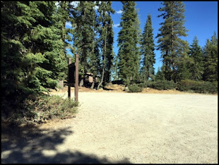
Very brief description: Primitive camping on the north side of a
shallow alpine lake in an outlying area, but available by car. Bring your own water. Poor signage in the area. The campground itself no longer has an identifying sign as viewed in the photo below.
Open Dates:
Depending on snow pack, Gumboot Campground is open from June to October.
Number of Campsites:
Six undeveloped sites with user made fire rings and some user made
pathways. Suitable for small trailers, campers
and tents. Max length of trailer 20 to
25 ft. but curves along the road can be tight and turnarounds will be minimal. Parts of the road leading to the campground
is in poor condition, although paved, and sections are very narrow.
Dispersed Camping:
There are a number of dispersed camping sites available for free
camping as you travel the road west of the Lake Siskiyou once reaching the National
Forest boundary as you head toward Gumboot Lake. Many of these sites are right along the road;
others are located on spur roads. For
detailed information on dispersed camping contact the Ranger Station or the
website.
Length of Stay:
Length of stay is not posted, but likely 14 days.
Fees:
None. Free.
Affiliation:
National Forest Service
Location/Address:
Gumboot Lake is approximately 16 miles from Mt. Shasta City on local
roads. From Mt. Shasta City at
Interstate 5 take the Central Mt. Shasta exit and go West on West Ream Avenue. Turn South on West Barr Road (Forest Route
26) towards Lake Siskiyou. Follow West
Barr Road and drive over Box Canyon Dam and drive past Lake Siskiyou. Continue on the road and pass the entrance to
Lake Siskiyou Campground. From there
continue along the same road and it will turn into Forest Route 40N26. This road follows the canyon of the South
Fork of the Sacramento River. In places
the road is very winding and narrow, drive carefully and watch for oncoming
traffic and wildlife. When you reach a
fork in the road at about 15.5 miles look for a fork in the road, take the road
to the left for ½ mile to Gumboot Lake.
Elevation:
Approximately 6,050 ft.
U. S. Forest Service
Mt. Shasta Ranger Station
204 West Alma
Mt. Shasta, CA 96067
(530) 926-4511
Amenities:
- · Pit toilets
- · User made fire rings
- · Hiking
- · Scenic
General Description:
Quiet and serene small alpine lake surrounded by a mixed conifer
forest. The lake sits in an open area
with some grasses around. A second, but
smaller lake is nearby to the West. A 2
mile drive from the lake is available to the Gumboot trail-head of the Pacific
Crest Trail. Views of Mt. Shasta and the
Trinity Alps can be seen. A 2 ½ mile
(one way) hike south on the Pacific Crest Trail one can view and explore the
Seven lakes Basin. Some individuals have
stated they can receive cell service in the open area by the lake, but it may
be dependent on the carrier. Most cell
service is unavailable past Lake Siskiyou (about 10+ miles).
Nearby Services: (groceries, medical, etc.) Food, fuel, water, camping or hiking supplies
are available in Mt. Shasta City. (16 miles) Supplies are also available in nearby towns such as Weed,
Yreka, or Dunsmuir. Nearest supplies would be in Mt. Shasta City.
Emergency: Full service Emergency in Mt. Shasta at
Mercy Medical Center (16 miles) and Yreka, at Fairchild Medical Center.


No comments:
Post a Comment